


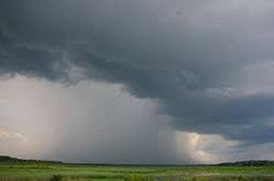
Most of SW Ontario is under a severe thunderstorm watch right now. Isolated thunderstorms are expected this afternoon, some with the potential of producing 50 mm of rain and 90 km/h wind gusts.
UPDATE: Environment Canada has upgraded the watch to a severe thunderstorm warning. This means the potential for severe isolated thunderstorms are imminent in Oxford County.
---
Environment Canada has issued a severe thunderstorm watch for most of southwestern Ontario, including Oxford County.
Isolated thunderstorms are expected to develop this afternoon. The worst hit areas could get hit with 50 mm of rain with wind gusts reaching 90 km/h.
There is the potential for localized flooding, particularly in more urbanized areas and areas of poor drainage.
Severe thunderstorm watches are issued when atmospheric conditions are favourable for the development of thunderstorms that could produce one or more of the following: large hail, damaging winds, torrential rainfall.
 Humane Society Seeking Home for Long-Term Resident
 WPS Briefs - Apr. 7th, 2026
 PJHL Playoff Recap - April 6th
 Oxford County Developing New Tourism Experience
 NDCC Nominated for BASF Grant
 New Poll: Artemis II Mission
 WPS Briefs - Apr. 6th, 2026
 WestJet Adding Fuel Surcharges
 BBBS Oxford Completes Fundraising Goal
 Construction Pending for Stover Street Bridge
 Gems and Java Fast Approaching!
 PJHL Playoff Recap - April 4th
 Artemis II Mission Approaching Moon
 Oxford OPP Address Video Circulating on Social Media
 Transport Truck Collides with SUV on Highway 403
 2026 Community Grant Recipients
 PJHL Preview - South Conference Finals
 Active Police Investigation in Ingersoll
 Easter Tradition Returns to Memorial Park in Tillsonburg
 Police Taking the Plunge for Special Olympics Ontario


Comments
Add a comment