

The City of Woodstock will be investing in new aerial mapping next year. The current maps the city uses for planning are over 30-years-old. And with all the development over the last 5-years, City Engineer Harold DeHaan believes its high time the city invests in some new mapping. "We had council approve half the anticipated funds this year with the intent of getting the other half approved next year so that next year we can have the whole city flown aerially so we can get an aerial photography of the whole city". The total cost will be around $70,000. The Engineering Department uses the aerial maps frequently to study flooding complaints, and for planning reports. DeHaan says new technology in aerial mapping would allow the city to have maps that are accurate within 8cms.
 Woodstonian Charged in Zorra Township
 New Program Launched at AHI and TDMH
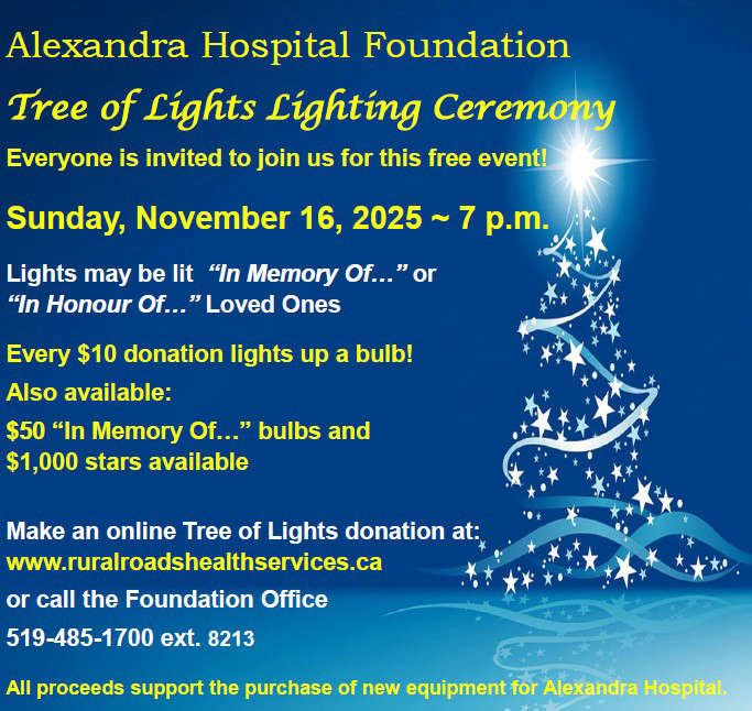 Tree of Lights Returning to Ingersoll
 Alexandra Hospital Receives $100,000 from ICF
 Witnesses Wanted in Crash Investigation
 Christmas Parade Hits Ingersoll Tomorrow
 Woodstock Man Charged in Brant County
 New Offices Coming to TVDSB
 UPDATE: Highway Crash Kills CMV Driver
 Stairway to Oxford Hits Norwich
 Oxford County Launches Tourism Surveys
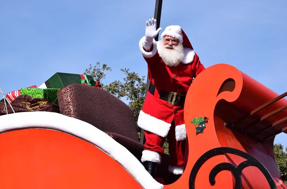
 Santa Claus Coming to Woodstock!
 Oxford OPP Briefs - Nov. 12th, 2025
 Charges Laid in Multi-Million Dollar Drug Bust
 PJHL Preview - Nov. 12th to Nov. 16th
 OLWN Increases Living Wage for 2025
 News Poll: Santa Claus is Coming to Oxford!
 Santa Claus Parade Approaches in Tillsonburg
 DASO Christmas Giving of Hope Returns
 Remembrance Day Ceremony Well Attended in Woodstock