

According to Environment Canada, southern Ontario could see some significant snowfall Thursday. In a special weather statement, Environment Canada says early models are showing an Alberta Clipper combining with a Texas Low over southern Ontario Thursday afternoon into the evening which could bring heavy snow and accumulations to some areas. At this time, snowfall accumulations are tough to judge but early forecasts would indicate 10 to 15 cms possible for areas north of a line from Grand Bend to Hamilton to Kingston. South of these areas could expect any where from 5 to 10 cms of snow. Environment Canada says these are early estimates and they are tracking the two systems as they approach the region. They will issue further special weather statements as necessary. The timing of the storm could make travelling difficult Thursday evening and especially for the drive into work Friday morning. It was just last Friday that a band of heavy squalls dumped heavy amounts of snow in the Woodstock area leading to a 50 car pile-up on the 401.
 3rd Annual Running with the Bulls Shines
 Mischief in Tillsonburg is Under Investigation
 Upgrades Completed for Woodstock Disc Golf Course
 OPP Enforcement for Civic Holiday Weekend
 Woodstock Candidate Profile - Anthony Scalisi
 Drug Trafficking Investigation Leads to Charges
 EZT Candidate Profile - Don Chowan
 Oxford County Requesting Public Input
 Norwich Man Charged in Brant County
 SPWH Wants You to Know Drinking Risks
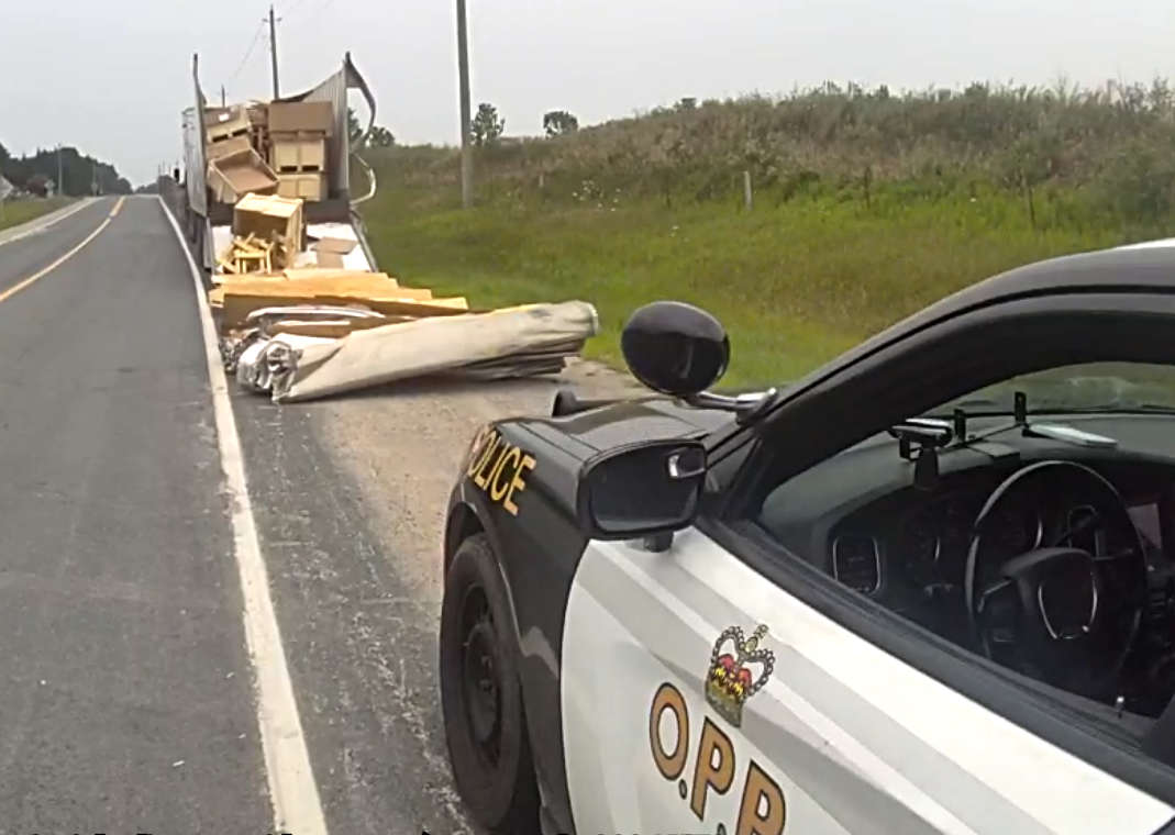 Charges Laid after Truck Hits Bridge
 Ingersoll Candidate Profile - Mike Tucker
 Motorcyclist Killed in Oxford Collision
 Tip Tuesday with the Oxford OPP - July 2026
 Oxford OPP Briefs - July 28th, 2026
 Cat Thrown from Vehicle in Norfolk County
 Environment Canada Issues Yellow Watch for Thunderstorms
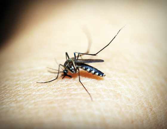 Oxford Mosquito Traps Tests Positive for West Nile
 Woodstock Candidate Profile - Sandeep Sidhu